Instructions for Side by Side Printing
- Print the notecards
- Fold each page in half along the solid vertical line
- Cut out the notecards by cutting along each horizontal dotted line
- Optional: Glue, tape or staple the ends of each notecard together
16
front 1 Low gradient is associated with deposition. True or false | back 1 true |
front 2 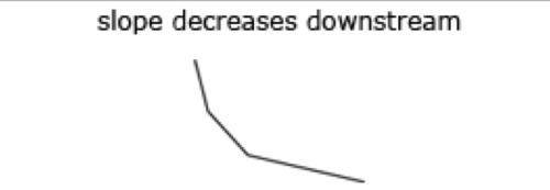 | back 2 slope of streambed |
front 3 Zone of erosion | back 3 - mountains |
front 4 Zone of transportation | back 4 - trunk stream |
front 5 Zone of deposition | back 5 - mouth |
front 6 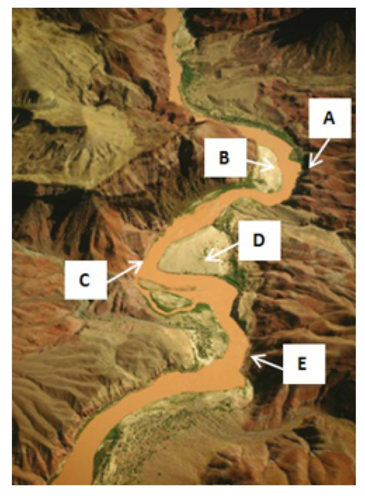 At which of the following locations is erosion occurring? | back 6 A,C,E |
front 7  At which of the following locations is deposition occurring? | back 7 B,D |
front 8 Which of the following statements about deposition and erosion around meander loops is true? | back 8 - Erosion occurs where water is moving the fastest along the outside
of the loop. |
front 9 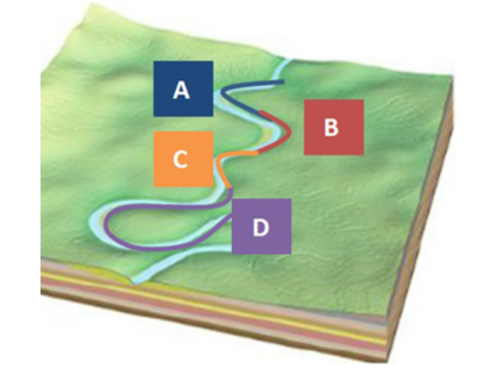 Which portion of the stream is the most likely to become an oxbow lake in the near future? | back 9 D |
front 10  | back 10 Dendritic pattern |
front 11 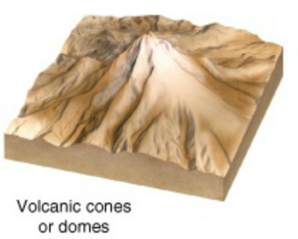 | back 11 Radial pattern |
front 12 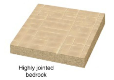 | back 12 Rectangular pattern |
front 13 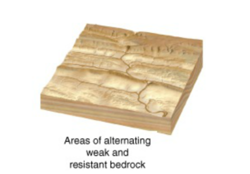 | back 13 Trellis pattern |
front 14 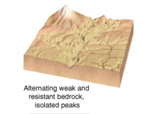 | back 14 Indistinct or multiple drainage patterns |
front 15 Direction and location of streamflow controlled primarily by geology | back 15 - Solid bedrock that is fractured in some areas |
front 16 Direction and location of streamflow controlled primarily by slope | back 16 - Peaks surrounded by valleys |
front 17 What causes meandering streams to downcut and become incised meanders? | back 17 uplift of the land the stream is flowing on |
front 18 Which of the following is likely to occur to an incised meander after it reaches equilibrium with its new base level? | back 18 The incised meander will cause only minor erosion of the canyon walls. |
front 19 Which of the following statements accurately describe the erosional processes of meanders that are incising and meanders that are in equilibrium? | back 19 - Meanders in equilibrium erode primarily in a side-to-side
manner. |
front 20 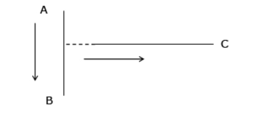 Using the example below, determine how flow will change as a result of stream piracy. The arrows indicate the original flow directions and the dotted line indicate where headward erosion has occurred. | back 20 Water would now flow from point A to point C. |